
|
Hely
Creek Sub Basin
|
Hely Creek is a perennial (year round) stream located in the Hely
Creek sub basin, which is in the middle of the Lower Van Duzen River
Basin. Within the last few years, many of the other streams in the
basin now appear to run dry or go underground during the summer months.
Many years ago, the Hely Creek was a prime habitat for salmon and steelhead
spawning in the Fall and Winter months. Currently,
it is rare to see any salmon spawning in the creek. Over the years,
Hely Creek has been the destination for many educational field trips.
The Creek is approximately 3.925 miles (6.317 kilometers) long, flows
through the old growth Redwood ecosystem at
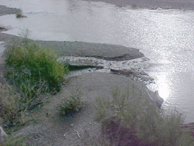
Mouth of
Hely Creek entering the Van Duzen River. Photo by Sal Steinberg
Hely
Creek has historically been a stream where members of the community
and visitors to the area could view salmon actively spawning. In
December 2006, a pair of steelhead were filmed spawning just past the
bridge, and in April 2007 steelhead fry were found in Hely Creek. The
Chinook salmon run has greatly diminished with the last salmon being
seen in in 2001, with at least 20 recorded spawnings in the creek.
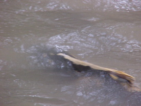
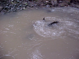
Salmon spawning
in Hely Creek. Photos by Sal Steinberg, Dec.8, 2001
Hely Creek has been a study site for the Science in the Schools Program for the past five years. The two photos below depict students engaged in field trips to Hely. Students from Cuddeback, Scotia, and Bridgeville work with scientists to study geology, water quality, fish populations, gravel content, and macro invertebrates.
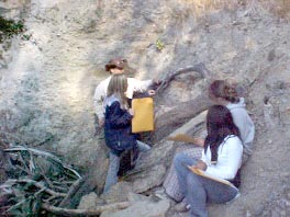
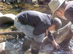
Photos by
Sal Steinberg 9/15/06
Hely Creek is contained within the Hely Creek sub basin which is identicle to the Calwater Planning Watershed of the same name. Increased timber harvest activity in the recent past has led to the accumulation of debris in the middle section of the Creek, as can be seen in the photo below. This debris accumulation has been documented by the California Department of Fish & Game Coastal Watersheds Project, as follows:
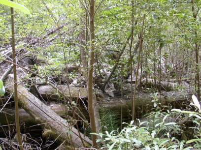
Photo by
California Department of Fish & Game Coastal Watersheds Program.
"The
main channel of Hely Creek has been split by a debris accumulation at
a site approximately 200 yards above its mouth. Flow has been diverted
to both sides of this debris accumulation, severely eroding both stream
banks and increasing channel width. Live trees now grow in the center
of the previously active channel, and they recruit sediment and more
debris. Our recommendation is to restore channel form by moving some
of the wood debris to open the middle of the stream, secure some of
the wood to arrmour stream banks around the site, and remove live vegetation
from active stream channel planting the banks as needed. There are other
sites like this along Hely Creek."
http://www.coastalwatersheds.ca.gov/VanDuzenLowerSubbasin/tabid/471/Default.aspx
During the 2007 Hydrologic Year, the Van Duzen Watershed Project monitored turbidity in Hely Creek, and well as many others in the Lower Van Duzen River Basin. Due to heavy fall and winter storms, large amounts of sediment and debris move through Hely Creek, as can be seen in the following photos.
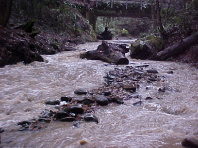
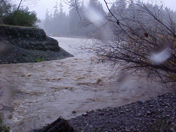
Photos by
Sal Steinberg, 12/26/06