|
|
Driving east on Highway 36, Cummings Creek is
located between Wilson Creek and Fox Creek monitoring sites but
is actually much closer to Fox Creek. Cummings Creek is a direct
tributary to the main stem Van Duzen River, merging with the main
stem in the lower basin considerably downstream from where it
emerges at the river bar. Cummings Creek runs downstream parallel
to the main stem for a considerable distance before it merges
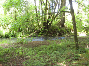
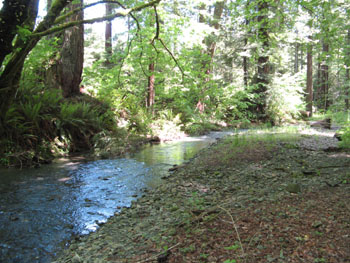
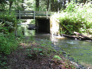
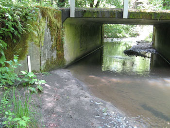
with the river. The Lower Cummings Creek monitoring site is located
in the redwoods very close to the Cummings Creek bridge on Highway
36, a little ways past the town of Carlotta when driving east.
The site is situated 40° 30.770' North and 124° 00.888'
West, and above it is a catchment area with approximately 11.9
miles of stream networks. Elevations in Cummings Creek range from
118 feet at its mouth to over 2.608 feet in the upper reaches,
and the monitoring site is approximately 161 feet in elevation.
The watershed is completely in private ownership with most of
the timber holdings and timber harvests by Humboldt Redwood Company
(formerly PALCO). Vegetation is predominantly evergreen (Redwood)
forest. The catchment area of a monitoring site is important when
considering upslope factors that affect water quality in the stream.
This area represents the true watershed that lies above the point
where water from the stream is sampled, and from which all rainfall
and sediment are channeled into the stream down to the point where
water is withdrawn for turbidity and suspended sediment analysis.
Stream discharge is directly proportional to the
size of the catchment area - the greater the area, the more water
is carried by the stream during storm events. The Lower Cummings
Creek catchment area is about average in size compared with the
other areas within the project area, and the stream drains an
area of approximately 11.8 square kilometers which is equivalent
to 4.6 square miles. As sampling at the Lower Cummings Creek site
was only initiated in HY08, there is no data for HY07. In HY08,
there was a maximum discharge of 144 CFS and an average discharge
of 47 CFS, a maximum turbidity of 1360 NTU and an average turbidity
of 148 NTU over the winter sampling season.
While Upper Cummings Creek is considered to be
a perennial stream and does run year round (as opposed to an ephemeral
stream, which runs dry in the summer), the stream is dry at the
Lower Cummings Creek monitoring site during the summer months.
Therefore summer temperatures were not measured at this site during
either 2007 or 2008. Lower Cummings Creek has a road density of
about 9.2 miles of roads per square mile of watershed. As with
all of the catchment areas within the lower basin, this density
of road networks receives a rating of extremely high. In the 17-year
period from 1991 through 2007, the proportion of the area harvested
for timber actually equaled 110%, with clear cutting accounting
for 13.4% of the total watershed area. Proportions greater than
100% are possible because areas are calculated to include re-entry
over multiple years. Calculation of overlapping THPs in forested
areas helps quantify the impacts of re-entry by logging operations
over multiple years, and sheds additional light on a process known
as cumulative effects.
|